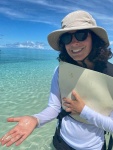

Emily Lazarus
emily.lazarus@my.jcu.edu.au
PhD
College of Science and Engineering

Emily Lazarus
emily.lazarus@my.jcu.edu.au
PhD
College of Science and Engineering
Cay geomorphology, dynamics and future prospects within the Great Barrier Reef
Emily is a geoscientist with an interest in the processes driving landscape change along the catchment to reef continuum. Her interest in research started with a research internship where she helped to develop a method to characterise and trace sediment particles from the catchment to reef. Emily then undertook an Honours project, in partnership with Dr Janice Lough (AIMS), which involved reconstructing a history of the Burdekin River discharge beyond the instrumental record to between 6,000 and 2,000 years BP. After several years in consulting, where Emily assisted local governments to develop Coastal Hazard Adaptation plans, she has returned to undertake a PhD researching the contemporary and future morphodynamics of cays within the Great Barrier Reef.
Cay geomorphology, dynamics and future prospects within the Great Barrier Reef
2022 to 2026
Project Description
The primary aim of this project is to quantify and characterise the physical and environmental controls of contemporary cay geomorphic behaviour within the Great Barrier Reef. In addition to this, numerical modelling will be undertaken to predict future geomorphic behaviour under sea level rise scenarios.
Project Importance
Cays are low-lying reef islands and are home to high-value ecological services, including sea turtle and bird nesting sites, and important vegetation species (e.g., Pisonia). They also hold cultural value to Aboriginal and Torres Strait Islanders. However, due to their low-lying nature, their persistence and continued ability to provide ecosystem and cultural services is threatened by sea level rise, among various aspects of climate change.
Project Methods
Remote sensing has been used to characterise the contemporary cay geomorphic behaviour and statistical analyses have been performed to determine the first and second order environmental and physical controls of this dynamism.
Field work has been undertaken at selected sites to capture high-resolution hydrodynamic data which will be used to validate the numerical models. In addition, RTK and drone surveys have been conducted to capture cay geomorphology.
Project Results
So far, this project has resulted in the development of a new method to quantify cay geomorphic change over various timescales which can be used by a range of users without a high degree of technical skills or knowledge. It is anticipated that this new method will allow marine park managers to rapidly undertake geomorphic assessments of cays which can inform appropriate management strategies.
The project has also resulted in a classification scheme which can be used by geomorphologists, scientists and managers to rapidly identify settings or characteristics of cays that are likely to have a high sensitivity to geomorphic change, allowing for prioritisation of management interventions.
Keywords
Climate change,
Coral reefs,
Field based,
Intertidal,
Mapping,
Modelling,
Monitoring,
Oceanography,
Quantitative marine science,
Remote Sensing,
Sea level rise,
Temporal change